Showing posts with label drystone walling. Show all posts

29 January 2016

Winter Work

This week's countryside blog comes from the Upland Ranger team based in the South Lakes area. 

When the team are working in the Fells a question we often get asked is:
"Do you work up here all year round?"
The answer to this is that we don't and this blog is about what we might be doing when we are not tackling erosion in the Fells of the Lake District.

We do spend much of the year in the Mountains and during the months between the clocks going forward an hour and until they go back again we expect to spend nearly all of our working time up in the Fells. This period is sometimes referred to as our "Fell Season".
 
Upland Rangers in their natural habitat during the "Fell Season"
(Taking a break before starting working on Striding Edge)

Outside of this "Fell Season", due to the shorter days and weather conditions, it isn't practical or safe for the team to stay in the Fells and we move onto work in the lower level Countryside. We call this our "Winter Work" programme (although it does include parts of Autumn and Spring too).

In general the team will help with anything that our Ranger colleagues in the South Lakes ask. There is never a shortage of lower level countryside work and we can find ourselves in high demand (it is not unheard of for our Area Rangers to "fight" for our time).

The examples below, from this years "Winter Work" programme, give an idea of some of the types of work.

We often work with rock and some dry stone walling is a common activity. There are always plenty of wall gaps to repair and we sometimes do some slightly more formal work too.  

Building a Dry Stone Retaining wall for a raised bed at Wray Castle
Another recent task, also using stone, has been some Slate-edged pathway.
A section of Slate-edged path at Wray Castle in progress

A common task in recent years for our Woodland Ranger is building tree cages to protect young trees.  This year has been no exception. 
Tree Cage under construction
(A nice winter day & a Wetherlam backdrop)

We might repair or construct countryside furniture such as gates, stiles and benches.  
Installing a new Bench at Wray Castle
(Donated by a family with connections to Wray Castle)

The finished Bench
We might also work in other areas of the National Trust where help is needed. For example the recent floods didn't affect our South Lakes area as much other parts of Cumbria and we have provided some support in other areas.
Helping clear a flood damaged fence with volunteers near Ambleside
Each year we usually help the Steam Yacht Gondola team winch Gondola out of Coniston Water and set up the frame to cover her for Winter repairs.    
Steam Yacht Gondola winched out of the water
The work we get involved in can be very varied and the examples above are a small selection based on recent months. Our team could be called on to help with any work needed in order to look after the countryside.

At this time of year we don't completely neglect our upland work and weather permitting we try to fit in some maintenance days. We also have an upland work party with the Fix the Fells Volunteer "Lengthsmen" at least once a month.
A Work Party on Browney Gill with the Fix the Fells Volunteer Lengthsmen
(A fairly grim day, we've had a few of these recently)
We also need to think about preparations for the forthcoming Fell Season and usually need to consider rock for our projects. There is seldom sufficient rock close enough to the paths we are going to work on and we may need to fill "heli-bags" so rock can be lifted to site by helicopter. This needs to be done in the early months of the year so it is ready for when we return to the fells. Carrying the heli-bags up to rock collection sites is often quite a good warm up for the main event of actually filling them.
On route to fill "heli-bags" with Rocks
(Image from 2013, we haven't started rock collection this year yet)
A bonus at this time of year, due to the shorter days, is that the light can be quite striking especially early morning or late afternoon as the sun rises or sets. A couple of recent examples are:
Sunrise along Windermere as the team started work at Wray Castle
Late afteroon light looking along Coniston Water at the end of a working day
If you would like to know more about the daily work of the South Lakes Upland Ranger team they can be found on Twitter @NTLakesFells or for more about Fix the Fells follow this link: Fix the Fells 

Posted by: Nick, Upland Ranger

16 January 2015

Step back in time in Little Langdale


It’s hard to avoid the eerie feeling that you’re walking in the footsteps of our ancestors when you cross Slater’s Bridge in Little Langdale.  There’s not a road or modern building in sight – barely a building at all, in fact – and with the worn stone beneath your feet, it’s easy to become lost in time.  Anyone at any point in the four-hundred years since the bridge was built could have done the same thing; gazed around at the same fells, peered down into the same smooth clear water flowing swiftly beneath.  On a misty morning, it’s almost a surprise that a pack-horse doesn’t come clopping over the hill from Birk Howe Farm.
Slater's Bridge in the timeless landscape of Little Langdale.  Photo Amy Askew.
While Slater’s Bridge might be the most iconic old feature in Little Langdale, the whole valley is rich with the signs and scars of centuries of human use, not to mention five legally protected Scheduled Ancient Monuments (SAMs).  

Industrial heritage

Perhaps the most obvious features (although not scheduled) are the quarries which dominate Tilberthwaite and the south-east part of Little Langdale along with their enormous spoil heaps.  Slater’s Bridge is named on a sixteenth century map so it’s thought that quarrying was already taking place here then – this seems likely as the stone for most of the Lake District’s old slate buildings would have come from small local quarries.  The Victorian era brought a full-scale ‘slate boom’ to Coniston and the surrounding countryside as people travelled from all over the country to try their luck in companies of four or five people.  The use of compressed air drills to make holes for blasting enabled exploitation on a huge scale and the creation of giant pits like Cathedral Quarry, Hodge Close and Moss Rigg.  The development of quality bricks brought large-scale slate quarrying to an end, and nature has reclaimed many of the sites – the peaceful valley we enjoy today is a far cry from the Victorian scene of heavy industry with drills ringing, dynamite blasts and the rumble of heavy sleds of slate being dragged along.

Three companies of quarrymen in their shed.  Photo courtesy of Alastair Cameron.
The area is also known for copper mining, and the most remote of Little Langdale’s SAMs is the Greenburn copper mine, tucked between Wetherlam and Wetside Edge, a mile beyond where you have to leave even a 4x4.  The site is huge and lots of the infrastructure for processing the ore is in good enough condition to give an idea of the scale of the operation in this lonely place, while tunnels (now closed) disappear up to 700m into the hillside.  Stone huts, a cavernous pit for a waterwheel, leats for moving water, and the remnants of a tramway are some of the most dramatic evidence of mining from the 1690s through to the late 1800s.

Greenburn copper mine with the wheel pit visible at the front right, looking down Greenburn to Little Langdale.  Photo Ian Taylor, geograph.org.uk
Ancient hamlets

Where Greenburn meets the main valley we step back even further in time.  Two catchily-titled ‘mediaeval dispersed settlements’ are scheduled near Fell Foot Farm.  These date from sometime between 1066 and 1500 and consist of the foundations of buildings and a kiln that is likely to have been used for drying corn; they’re only visible now in the straight lines of giant boulders used for their foundations.  Lots of people in Cumbria lived in these ‘dispersed settlements’ during this period, with villages spread across entire valleys, a house or two in each hamlet, and their occupants sharing open common grazing on the surrounding land. 

Straight lines of giant foundation stones are all that's left of the hamlets.  All the smaller stone would have been scavenged to make more recent walls like the one towards the back of the picture.
The dry stone walls we see today were laid over this landscape during the following few hundred years and you can see the evidence of this ‘layering’ effect where some of them run across the foundations of these settlements.  The more intricate patterns of walls in the smaller fields in the valley bottom were built first as people started to manage larger flocks and herds more intensively and needed places to sort and store them; from 1690 a series of Enclosure Acts then allowed landowners to effectively privatise common land, eradicating the common rights.  The dead straight lengths of wall arcing miles over the fell tops date from this period as landlords marked their territory and controlled the grazing on it.

Please note that there is currently no public access to the mediaeval settlements.

This long, straight wall dividing Great Intake on Low Fell from the fell grazing on Wetherlam is likely to date from one of the Enclosure Acts.

 Vikings and Romans

Tucked away directly behind Fell Foot Farm is the site that speaks most to me – the Ting Moot (AKA Thing Mount/Mound – take your pick).  This terraced rectangle of earth, about the size of a tennis court, was a meeting place that is likely to have been built during the 'Viking' period between about 800 and 1066.  The Norse settlers had a very strong influence in the Lakes that we can see today in place names and words like beck (for stream, from the Norse 'bekkr') and fell (from 'fjall', Norse for mountain).  Courts would have been held at the Ting Moot as well as day to day meetings to administer the affairs of the area.  Little Langdale would have been chosen as this spot is central to the southern part of the region, with access possible over Wrynose Pass from the west and via Ambleside from the south and east; the passes here were a major trade route, and you can just about pick out the route of the Roman road (which the current road follows over the passes) in the field in front of the farm.  Standing on the road by the Ting Moot, with the Roman road in sight and Wrynose disappearing vertiginously behind you, it’s easy to see why this spot would have had such power. You can imagine the importance this route must have had when travelling the Lakes by foot or horse, with the valley opening up impressively below while Castle Howe rises sentinel-like directly above.
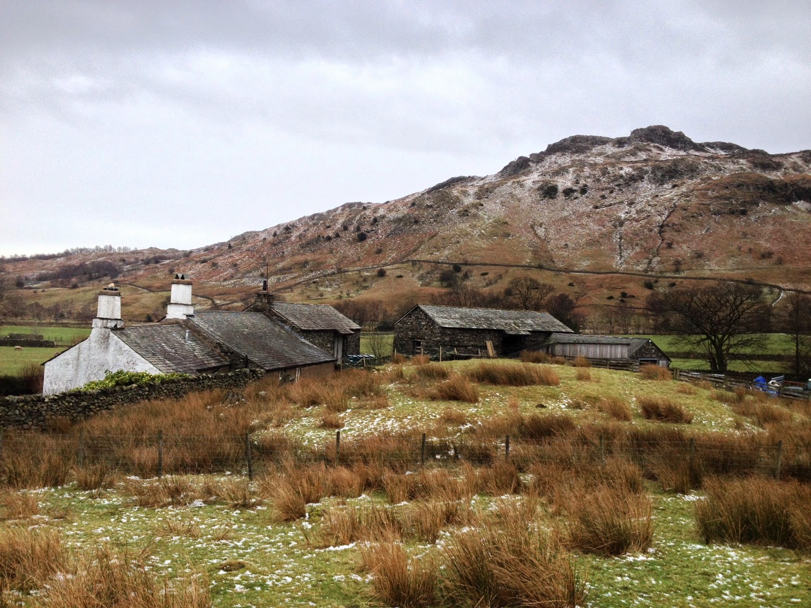
The Ting Moot tucked away behind Fell Foot Farm.  The terraced edges are very obvious when you visit.
Speaking of Castle Howe, this is the last of Little Langdale’s scheduled monuments, but unfortunately it seems likely that its history isn’t so compelling.  Although it was scheduled in 2001 as an Iron Age hill fort (based on research from the 1920s), current thinking is that it’s probably not a fort at all - although, as with all archaeology, we can never be certain.  The ditches to the west of the peak, which were originally interpreted as man-made defensive features, are now thought to be natural, and a look at the summit suggests that even if ancient people had created a defensive cordon here, there would be nowhere inside to make buildings or live due to the steep and rocky ground.  Although its human history is in dispute, Castle Howe is a fascinating piece of geology known as a dyke, formed by a plug of lava cooling in a vent from a giant volcano.  It's consequently made from harder rock than the surrounding area so while the rest of the landscape was eroded under the glaciers of successive Ice Ages, these lumps - like Tarnclose Crag and the Langdale Pikes to the north - stand ruggedly proud.     

Castle Howe (on the right) rises above Fell Foot Farm and the Ting Moot, with Greenburn and Wetherlam beyond.
There’s a huge amount more history in the valley that there’s not room to cover here – each of the farms is a fascinating tale in its own right, for instance – and this just demonstrates the rich story the landscape of the Lakes has to tell.  Little Langdale is considered one of the Lake District’s gems in terms of scenery, but scratching beneath the surface can add a whole new level of interest to your hike; the valley is the perfect place to start an archaeological investigation and walk in the footsteps of our ancestors.  

The rangers work hard with the National Trust regional archaeologist and building teams as well as the tenant farmers to ensure our Scheduled Ancient Monuments and the rest of the amazing history in our landscape is looked after as well as possible.  Sometimes this means excluding livestock or cutting vegetation on a monument to ensure it's not eroded, while other times we need to get the experts in to find out more information or carry out structural work.  Keep reading our blog to find out more about our varied work in the South Lakes.


7 March 2014

A wall with no mortar


Drystone walls ….. If you spend any time in Cumbria they’ll be a familiar sight and if you spend any time working in conservation they’ll soon become a very familiar sight. They’re called drystone because they have no mortar to hold them together, just a set of rules that are applied to every stone you put on the wall. How fast you do it often comes down to how often you do it – practice makes …. well, let’s say gradually improving ….
It's always a right mess when you start, but all those stones need to go back

A National Trust drystone walling working holiday getting some practice in ....
Here’s some of the basic drystone wall rules:

  • Build the wall with two ‘skins’, with a centre of smaller stones (hearting)
  • Try to use the biggest stones at the bottom of the wall, smaller ones higher up.
  • Always place the stones on the wall so their tops are not tipped up, they are level flat.
  • Two on one and one on two – always try to cross the joins by placing the next stone so that it spans the gap between the two stones below it.
  • Place stones so their length goes into the wall, not along it (a tracer)
  • Try to ensure the outer faces of the stones present as flat a surface as possible.
  • Your wall should be roughly twice the width at the bottom it is at the top. This gives it it’s ‘batter’, or sloping face.
  • Finish with a row of larger stones to pin it together (the ‘cams’)
Starting with the biggest stones at the bottom
We’ve had lots of opportunity to put those rules into practice recently. The Red Nab bridleway runs from a popular car park towards Wray Castle, much of it flanked by a wall. It was starting to look like a very tired wall too and in great need of some TLC, which is where we came in. For the last two years we’ve repaired many sections of it, all with the help of volunteers. We recently had one of our last days there with the local group the South Lakes Conservation Volunteers, putting the cams on a long stretch.
South Lakes Conservation volunteers adding the final 'cam' stones
It was a nice feeling to be wrapping things up there but we wonder if it won’t be long before we return. The trouble with fixing up the worst bits of a long wall is that the bits that weren’t so bad suddenly look like the new worst bits by comparison. And that’s where another simple rule comes in:

  • For your own sanity, know when to stop ….! 

By Rob Clarke, Basecamp Community Ranger

16 December 2013

Two days and three nights of festive activities at High Wray Basecamp

High Wray Basecamp was built to be used and is always at it’s best when it’s full up with volunteers. This is why one of our best weekends of the year is the now traditional Fix the Fells lengthsmen’s Christmas bash. We’ve hosted this for the last four years now and this year was the biggest and best yet!

Walling on Red Nab bridleway on Friday
It all started on Thursday night. A few volunteers who live the furthest away arrived to stay over (quiet night in) and be ready for Friday’s work day drystone walling us on the Red Nab bridleway. More people arrived on Friday morning, swelling the numbers to around 15 people. We had a fine day’s walling in very mild weather, at the end of which some went home and a few more stayed over (a less quiet night in), ready for the main event on Saturday.

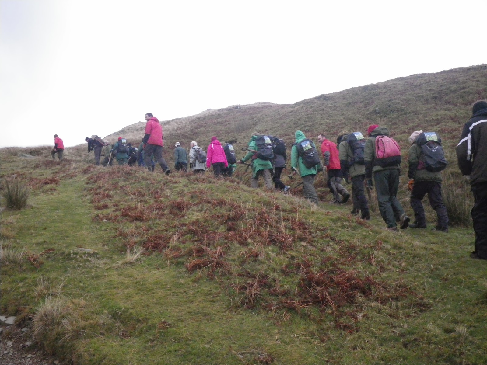
The volunteer army moves out!

Saturday came and more arrivals saw the volunteer army up to full strength, with 34 ‘Fix the Fellers’ heading over to Coniston to join with the South Lakes upland path team and members of the Western and Northern valley’s teams. On site, they divided to work on two sites with a smaller party fixing some leaking stone drains on one path and the bulk of the numbers working to landscape out shortcuts and plant trees on another.

Team two on the drain repair
While everyone was out having muddy footpath repair fun, we stayed back at Basecamp getting the place ready for the evening’s festivities. A full day hoovering, moving tables + chairs, cleaning and decorating gave us just enough time to be ready for the now very hungry volunteer’s return from the fells. A proper slap up Christmas dinner expertly prepared by Ian, a long standing group member, was the perfect end to a great day. This was certainly not a quiet night in!

Cheers! The well earned xmas meal
Social events are often an important part of volunteering and can really help bind a group together, so it’s great for us at the volunteer centre to be able to host things like this. It was a very cordial evening indeed, although it has to be said from past experience we’ve learnt it’s best not to plan for any work to be done on the Sunday ….

12 April 2013

The end of an era ...

So far this year we’ve been exceptionally lucky with the weather. We had one day where we ended up building the drystone wall in the ‘Outdoors indoors’ room (see 26th March entry) at Wray Castle due to heavy snow preventing us getting to the real wall we were intending to go to, but apart from that it’s been fine every time we’ve had volunteers out with us.
 
Not a usual walling problem - fitting stone next to a skirting board!
So this run of decent weather (ie not raining) has meant we’ve been able to get back down to our ongoing project putting the new path in on Wray Bay, just down from the castle. We started work on this way back in August 2011 and have been plugging away, working towards the castle ever since them.
 
Landing party! Brathay Trust arrive at Wray Bay .
In a first for us, the weather was so good that on one of the days the group we were working with arrived by canoe! They were all local young people staying at nearby Brathay Hall and working with us as part of a Princes Trust project. They’d all never done anything like this before and were all saying they would be bringing their families back to look at their bit of path. The National Trust’s new director general happened to be at the castle on the same day so the group also got to give her a lesson in how to use the power barrow – which we think was probably a first for her too!
 

Dame Helen Ghosh with her power barrow tutor ...

It’s been great having a big project like this to work away at, but it’s coming to and end now. A recent day working there with Littledale Hall Therapeutic Community, a residential rehabilitation centre from near Lancaster, saw us put the final turf in place on the side of the path. Quite emotional really ….
 

Littledale Hall putting the final turfs in place

There’s a couple of days work left to do yet, laying the rest of the gravel path surface and tidying the site up. But it’s very satisfying to look back on the completed path and remember all the many different volunteers who’ve put their bit into the project. This path is a true testament to the statement 'we couldn't have done it without them' .....

 By Rob Clarke, Community Ranger, High Wray Basecamp